Wandering through the moonlit towers of Bryce Canyon, breathing in the crisp night air, I pondered on how many people had shared this experience. Who were they? What had brought them to that point? How did they see this alien world differently than me? As my mind explored it’s thoughts while I explored the canyon, I came to a profound realization: I stopped, patted my pockets down, and found out that I no longer had my car keys.
Intro
While I was in New Zealand, I was able to talk to Kiwis from Auckland who remarked that they had never been to Stewart Island, or who had planned to do the Milford Track for years. This struck me as almost negligent, having access to all these incredible places to see, yet never taking the time to get out and experience them. However, when I returned to Colorado, I realized that I was no better: though I have been a fairly avid outdoorsman all my life, it’s almost always been places I’m comfortable. I would go to the trails that I had done before, because I knew what to expect. The reality is that my most memorable experiences had been things outside my comfort zone: Canoeing in the Boundary Waters, two week long backpacking trips in New Mexico, or Backpacking in the Fiordlands of New Zealand. With this in mind, I decided that I wanted to start exploring. I set up the back of my pickup to function as a small living space, and bought an Atlas. I started highlighting places I wanted to go, and packed my bags. Then… I put it off. I didn’t do it. Even though I had the free time (being unemployed), I let my comfortable internet take away that time, and my comfortable bed coax me out of it. Finally, I realized that my Parents would be coming into town for a couple family reunions that I would take away any long amounts of free time that I had, and the longer I waited, the more likely I wouldn’t have the correct time again. So at 7:00PM on May 17th, I decided I was leaving the next morning.
Day 1: Intro 2
With that said and done, Day 1 was pretty uninteresting, as far as days go. I had to stop by my parents’ trailer in a small town in southern Colorado to pick up my camp stove, and stopped by Denver to pick up a couple random supplies from my Uncle (a very avid camper). One more thing: here’s a map of the route, in case you want to look ahead.
Day 2: Sand Dunes
The last time I had been at the sand dunes it was below freezing, and the time before that was when I was in Junior High. As such, I was pretty excited to get a chance to revisit the dunes when it was pleasant. However, my hopes were seemingly dashed early when it started to snow on the drive there. In slightly dampened spirits, I continued driving up to the parking area, where I saw there were 3 buses full of elementary kids just eating lunch. Though this annoyed me at first, having them disturb the peace I had hoped to find there, I realized that they weren’t bothered by the mid 40s weather, and they had had a blast on the dunes no matter the temperature. So, even though I knew there were possible thunderstorms rolling through the area, I decided to take a hike up the Dunes, just for fun.
 Turns out I got all the way up. And it was a beautiful view:
  The moisture in the air condensed from the altitude of the mountains, and made some dramatic clouds. I couldn’t stay up there for long, though, since I could see the storm clouds moving across the plains of the San Louis Valley towards me.
I made one more stop before heading to Alamosa: Zapata Falls. This is a waterfall that is quite close to the Dunes. I had been there in Junior High, and I remembered that the water was frigid, as seeing the falls requires you to walk up the snow-fed stream through a short canyon. I brought some sandals along though, which served me very well.
After I got back from Zapata Falls, I headed to Alamosa to stay with some relatives there. I was glad to be able to wash the sand out of my hair, and get ready for the next day, which ended up being quite long indeed.
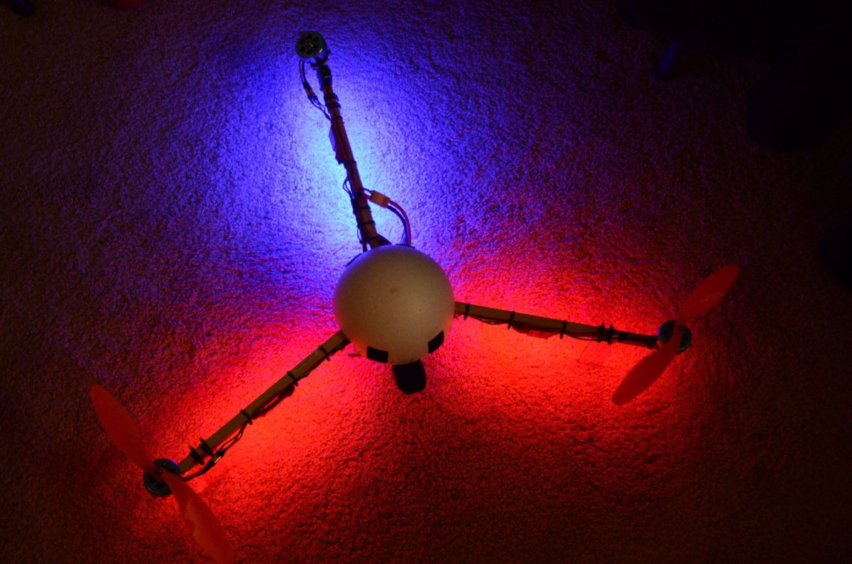
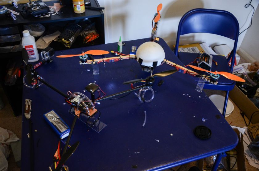
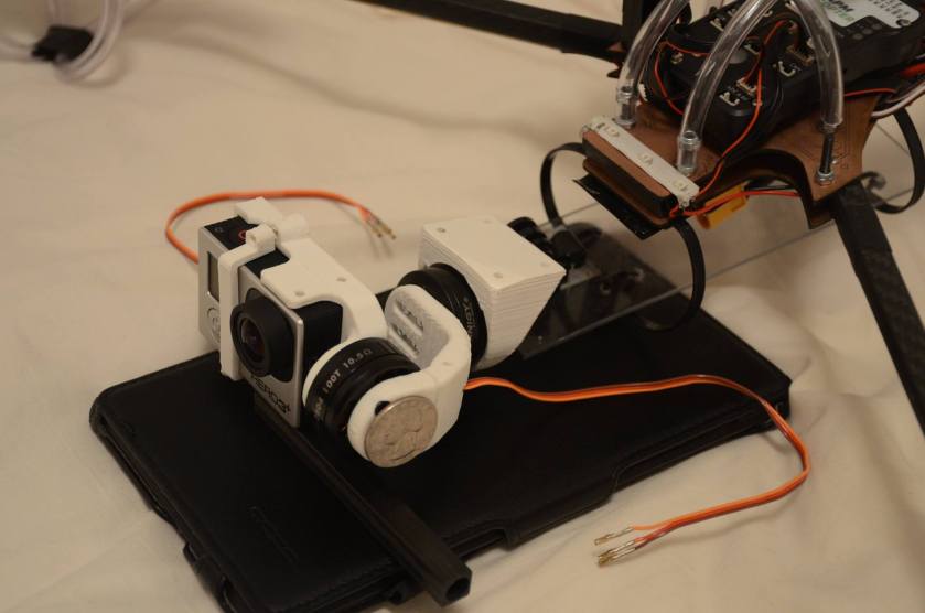
There’s a big gap here because the post editor isn’t very good at putting in long images with text. If you find this, good on you mate!
Day 3: DRIVING
Unexpected treats are always pleasant, and the random waterfall between Alamosa and Durango was unexpected, and quite a treat! I saw the sign for Treasure Falls as I was passing it, and decided (luckily) to turn around and check it out. I’m very glad I did:
 I am exceedingly happy with this picture. Foremost, I can tell that I’m improving with my photography. I decided to do a ‘shorter’ exposure of 1/4th of a second, rather than the 3-4 seconds that I had done on previous waterfalls, to simulate the movement of the water but still having some detail. I was able to edit it in a way that I’m very happy with, and I used all the tools that I could use to bring the best picture to fruition (in my opinion). All in all it turned out quite well, and it was well worth the 30 minutes I took out of my driving time to check it out.
I continued on to Mesa Verde, which was one of the big things in Colorado that I almost forgot was actually in Colorado.


Just looking at the cliff dwellings, I thought to myself “Those must have been crazy awesome to live in”, and I just kept wondering how the decision to make them went: “Hey man, know what would be cool? Living on the side of a cliff!” “Yeah, that would be totally rad!” etc (I’m sure that’s exactly how it went down).
I didn’t have much time to dwell there myself, as the afternoon was quickly coming to an end. I left Mesa Verde and talked to a Park Ranger on the way out to figure out a good place to camp for the night between Mesa Verde and the Grand Canyon. As it turns out, it was almost entirely in the Navajo Nation land, where there isn’t any free camping or dispersed camping, so my options quickly became very limited: Either stay near Mesa Verde and have a very long day the next day, or have a very long day that night, and simply drive another 7 hours to the Grand Canyon. I chose the latter option.
It was a very dramatic drive, since it takes you out of the mountains of Colorado (through the Four Corners, which was entirely underwhelming) into the Desert of Arizona. Taking this trip, I realized that there are many more types of rock formations than I could possibly imagine.
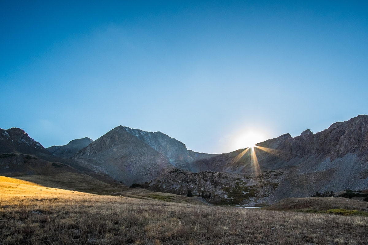
I stopped by Monument Valley (an additional hour out of my way) to check out the sunset. Though it didn’t present me with too many dramatic colors, the light on the towers there was dramatic enough for me, and I’m glad I took the opportunity to see the iconic pillars.

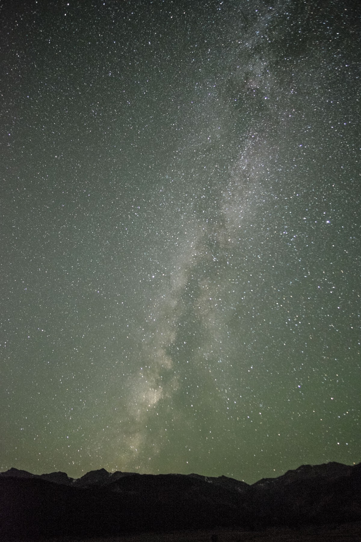
Before I got to the National Forest close to the Grand Canyon where I was going to camp, I got out and took some night time shots of the Vermilion Cliffs by the light of the almost full moon. By the time it was all said and done (and after another 30 minute detour accidentally turning on the wrong road) I got into my campsite around 2:00am. I had driven for probably at least 10 hours that day, and I was ready to hit the hay.
Day 4: Grand Canyon
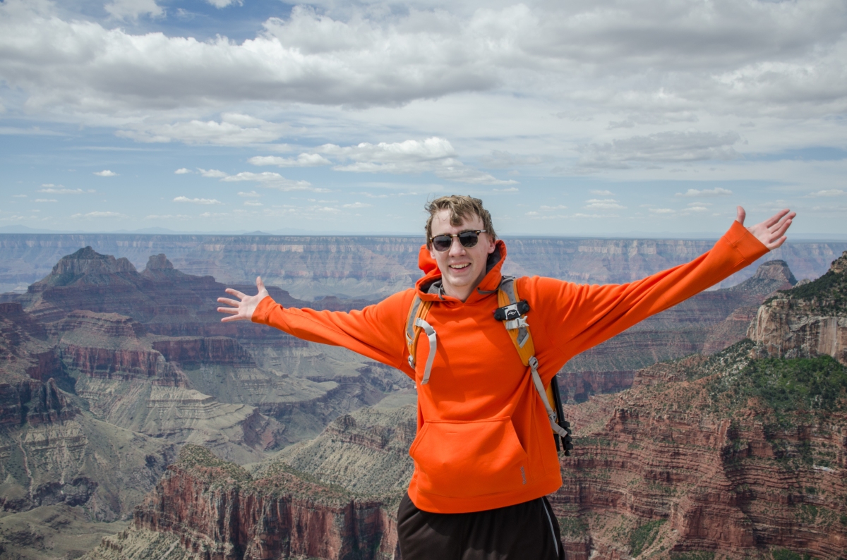
More specifically, the North Rim of the Grand Canyon. Though it is said to be the less popular of the two, it was far from unpopular. The main parking lot was nearly full when I got there, probably because I had slept in quite late. 
I managed to do a couple short hikes around the rim with some spectacular views, but I was left wishing I could do more. I think I would have enjoyed hiking down into the canyon itself had I planned more time. Perhaps next time.
I drove on to Zion National Park next, and planned to camp in my truck south of the park, meaning I got to drive through it on the way there, which completely blew my mind (But we’ll get to that tomorrow). I four-wheel-drove to a pretty out of the way camp site with some very dramatic views and noticed I had full bars of 4G coverage, so I took the opportunity to skype with my brother to show off where I was. I made dinner, cleaned up, then finally went to sleep for the short amount of time until…
Day 5: Zion
Somehow, I had never really seen much on Zion. I had no preconception of what it would look like, no expectations of it. And it totally blew me away. The colors of the rocks, ranging from white to yellow to red, the scale of the cliffs rising all around, and the uniqueness of environment that I had never experienced before instantly cemented it in my mind as one of the greats, on par with Yellowstone, Rocky Mountain and Yosemite. On my trip, I had planned one day to use as a floater, to spend an entire day at one place. I knew that Zion had to be that day when I first drove in.
I wanted to go backpacking that night, and saw that the West Rim looked like an awesome place to go, so I decided to try to get a backcountry pass for it by getting to the visitor center super early and waiting in line. I wasn’t sleeping well at all, and I woke up at around 4:00am and couldn’t fall back asleep (mostly due to the wind howling outside). I set off around 4:15, and got to the Visitor center at about 5:00. It was a Saturday, so I was pleasantly surprised to see that I was the first one there. Turns out I vastly overestimated the amount of people who would be there on a Saturday: I was the only one there for another hour and a half. The next people to show up did so at ~6:30, only 30 minutes before it opened. So I was a little bit disappointed, because that meant I could have gotten more than ~3 hours of sleep. To top it all off, once inside, the West Rim was completely full anyway, so I had to choose another campsite. Talk about a disappointing morning…
But I wouldn’t let the morning ruin the rest of my plans, so I made some breakfast, then hopped on the shuttle up the Canyon. The Narrows were closed, but I walked up to them at least, and did a couple side hikes before deciding to ascend Angel’s Landing. This is quite the hike: though it is only 5 miles roundtrip, it includes 1500′ elevation gain, and the last half mile requires the use of a chain to navigate some very exposed areas, along with hundreds of other people trying to move past and along with you. Nonetheless, It was an incredible hike, and the views from the top were gorgeous.
I headed back down fairly quickly however, since it was getting hotter, and I didn’t want to start too late backpacking in to my bed that evening. I ended up heading back to the Backcountry desk, and getting a new campsite on the East Rim –which meant I didn’t even need to get there that morning at all. But I was much happier with the East Rim than I would have been in the Southwest Desert, so it all turned out well.
I dallied around for a couple more hours before I headed to the trailhead to get to my campsite. By the time I started hiking it was 5:30pm, with the sun starting to dip in the sky, and I was not ready to backpack whatsoever. Even though it was just 3.5 miles in, the first mile was a struggle to not turn back and sleep in my truck. Between the minimal sleep the night before, the strenuous day, and the late start, I was extremely close to giving up and turning back. I powered through though, and I’m glad I did, because I ended up staying in one of the best campsites I have ever stayed at:
I set up 3 feet from a 2000foot cliff, with an incredible moonlit view of Angel’s Landing below. I didn’t get much chance to appreciate it, however, because I went to bed as soon as it got dark, and slept for nearly 12 hours.
Day 6: Bryce Canyon
Waking up the next day was glorious. I had made up for my sleep deficit, and the view was unbeatable. It was a shame I had to repack everything and hike back out. I got back to my truck around noon, then headed out to Bryce. The drive was nice, greener than I was expecting, and it included a section through Red Canyon, which was another page in the book of “Bizarre Utah rock formations”. I’d love to go back there to do some drone shots (since it was a national monument rather than park). I got to Bryce around 4:00, so I was presented with some nice late afternoon light while I was hiking around.
However, my time here was just beginning. I cooked some dinner in the parking lot while the sun went down in the sky, and started packing my camera bag for the evening. When the sun finally set, the full moon was just rising, so I rushed over to try to get a nice shot of it (I didn’t). I packed my bag up again, and headed down into the hoodoos for a night hike.
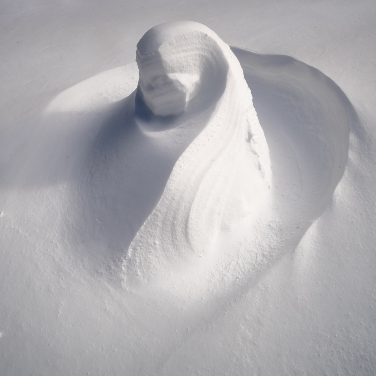
The hike was amazing. There was a ranger-led group of people doing a moonlit hike within the first half mile, but after that, I was alone. There was no wind, no sound, no distractions. The shadows from the full moon on the unreal columns around me just took me out of where I was, and it was incredibly peaceful.
However, not all was well: I realized within the last half mile of the 3 mile hike that I had lost my car keys. The final ascent back up to the rim of the canyon was much less peaceful than the rest of it, trying to figure out where I might have dropped them.

I had ended up dropping them when I took my camera out to shoot the moonrise, which happened to be within 25 feet of where I came up from the hike! Needless to say, I was stoked, since they were very close to sunset point, a very popular overlook. I grabbed my keys and headed out. There is a National Forest access road within half a mile of the exit to Bryce, so I pulled onto it and parked by the side of the road to go to sleep for the night.
Day 7:Moab
I started this day early, getting out to Bryce Canyon again for the sunrise. I talked to another photographer there from England, and took some nice timelapses. Most importantly, I was able to take an 8 minute shower for $2. It was glorious. After I cleansed myself, I headed off towards Moab, through some very cool canyons in Grand Escalante-Staircase National Monument, then Capitol Reef National Park. This drive was incredibly stark, as I went through some of the most desert-y portions of Utah that I’d ever been in, with hardly any plant life and lots of rocks.
I made it to Canyonlands, and did some hiking, but I wasn’t fond of the hiking there, so I didn’t stay for long. I did take a cool picture of an arch though!
I had to wait 15 minutes for people to clear out of the picture, but the clouds weren’t in any hurry to move. After this, I headed to Moab to a Mexican restaurant for dinner. After all of the dehydrated pasta I’d been having for the past week, it tasted like heaven. Also while in Moab, I started figuring out where I was going to camp that night, since almost all campsites nearby were pay sites, and I’m cheap. I talked to a friend who frequents the area, and found some choices. By that time, the sun had set, and I headed off towards Arches.
When I got to Arches, it was around 9:45. I figured most people would be out of the park by then, so I was definitely surprised when 50+ cars in a row passed me right as I entered. I couldn’t figure out what it was right then, but later figured out that it was the crowd of people who were watching the sunset at Delicate Arch. I got to the Delicate Arch trailhead 30 minutes later, and headed out soon after that. I passed a few people who were coming back on the 1.5mile trail at the beginning, but I had most of the trail to myself until the end, where there were 4 other photographers waiting for the moonrise. We talked for a bit while waiting for our pictures, then the last of them left around midnight, leaving me alone with the arch, which was quite cool (and probably the only way to be alone there).
After hiking out alone, I ended up sleeping at a ‘paid’ campsite not too far from the park in one of the group campsite parking lots, at around 2am.
Day 8: Dinosaur
Since I didn’t want any trouble (for not paying! *gasp*), I ended up leaving back to Arches soon after sunrise. I hiked around a few of the arches I couldn’t see the night before, but I was exhausted from the lack of sleep the night before, so I took a couple 1.5hour naps in a couple different parking lots. By the time I woke up from my second, it was probably about 10:30am, and the park was completely full. Any parking area I passed was filled with cars, and when I got to the entrance, there was a line 70+ cars long just to get in. I’m glad I got there when I did.
From there, I headed back into Colorado to my final destination of the trip: Grand Junction! (Just kidding, it was actually Dinosaur National Monument). When I got there, it was raining, windy, cold, and starting to get later in the afternoon. I was highly tempted to just skip it, and head back to Denver to get in late and sleep in a warm bed. I did not, and once again, I’m glad cooler heads prevailed, because the camp site I went to was sublime.
 The drive down to Echo Park campsite wasn’t necessarily 4WD, but there were places there may have been clearance issues for smaller cars. It was an incredibly scenic drive, complemented by the light of the setting sun. You drive across a large plain before a gaping canyon opens to your left, and before long, you start driving down into another canyon in front of you. Eventually, the road is wandering along the bottom of the rocky canyon, until it opens into small grasslands between the cliffs. Before long it opens into a large clearing, and this is the campsite, situated at the convergence of the Yampa and Green rivers. With sharp cliffs rising all around you, and a gentle breeze blowing through the knee-high grass and cottonwood trees, it was incredibly peaceful, and it made an awesome final day for the trip.

Post-post post
This is the post at the end of the post. If you made it this far, I applaud you, and I encourage you to go find an adventure of your own. It’s much easier than you think, 5 hours isn’t that long of a drive, neither is 1 hour. You’ll thank yourself for motivating yourself to Just Do It™, and make memories that last much longer than the time you got 3 hours of sleep and were super cold. Go live life to the fullest, or something similarly cliche! Thanks for reading, and I hope you enjoyed my photography if anything!
SECRET TEXT! LEAVE A COMMENT IF YOU FIND IT FAM